
Monumentality in Microcosm
1880-2012: The Emergence of Triangles
Many of the spaces for triangular parks or "Reservations" do not become legible on maps and planning documents until the 1870s, when a huge program of public works were initiated by the Territorial Government's Board of Public Works. For the first time, the muddy streets of Washington, D.C. were graded and paved.
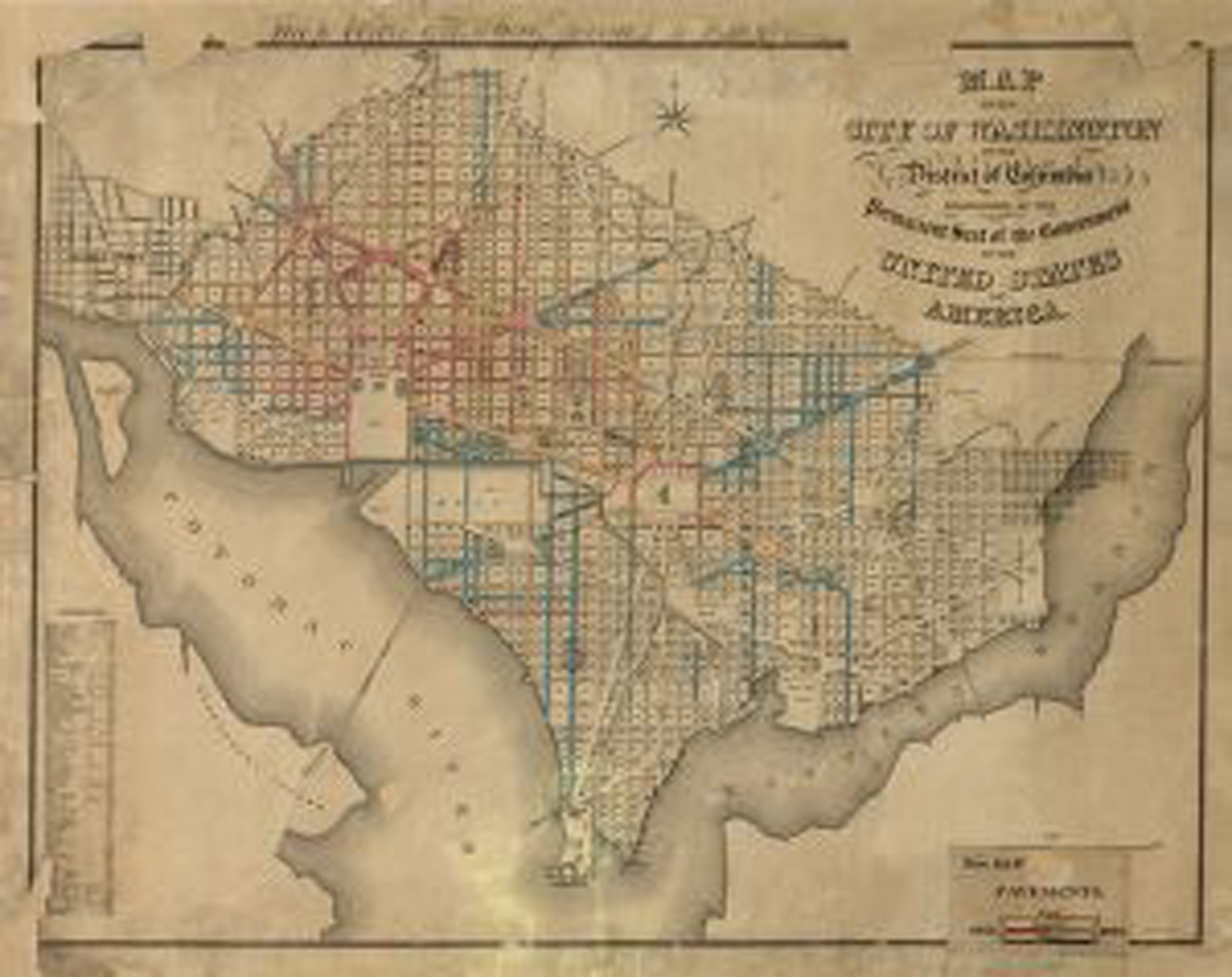
1873 (W.J. Stone)
The District's government continued the legacy of systematic infrastructure works. This 1880 map from the City Engineer indicates extensive street paving. At this time, triangular traffic islands start to become clearly discernible amongst the complex street intersections.
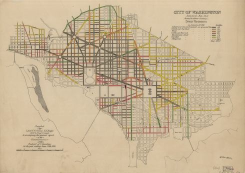
1880 (F.V. Greene)
This 1891 paving map expands beyond the historic boundary of the City. Triangle parks also formed at irregular street intersections of outlying neighborhoods; though with less regularity and even distribution than in the core.
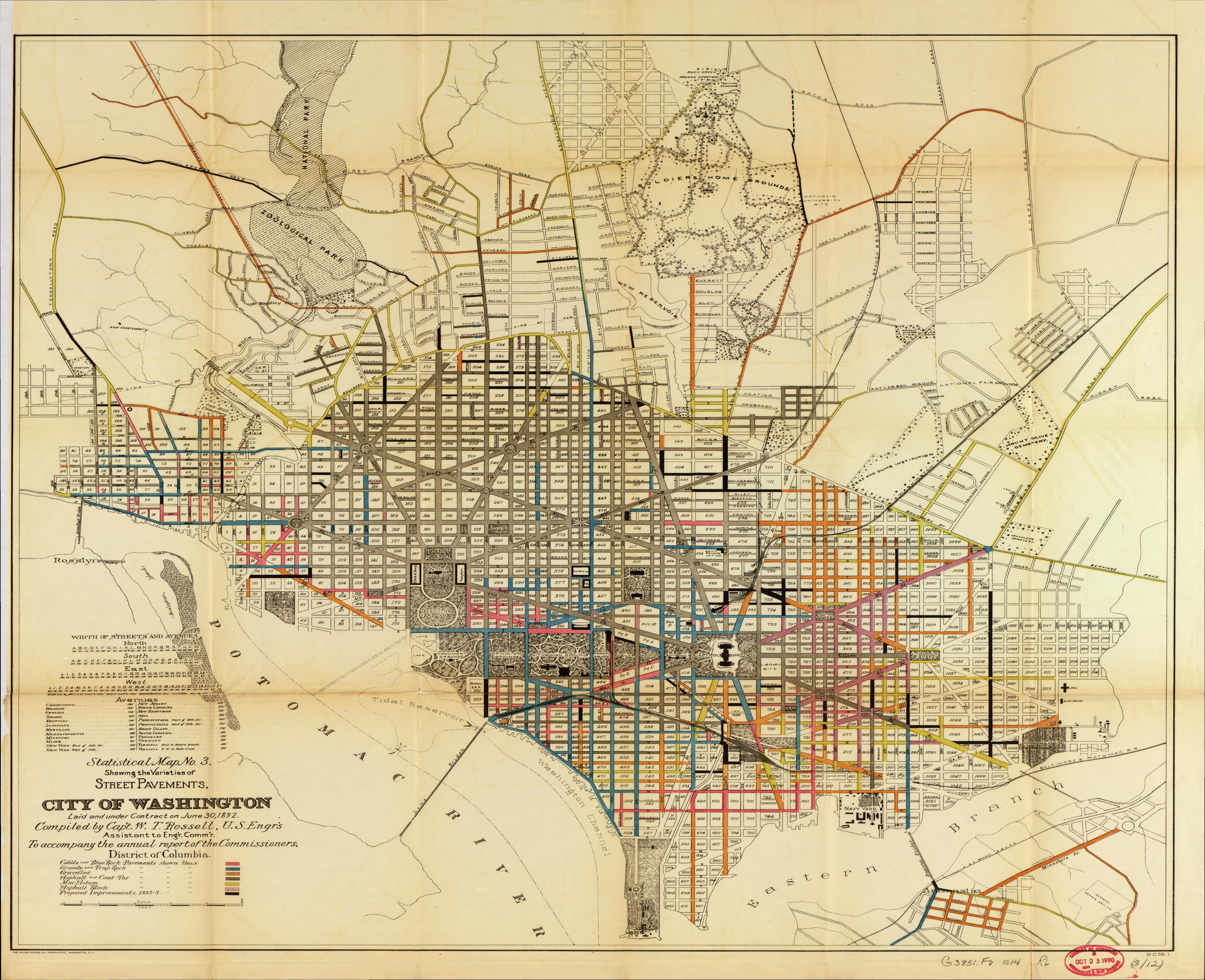
1891 (W.T. Rossell)
This map from 1894 is one of the first catalogues of public space which included small reservations. It identifies 301 reservations that were confirmed in 1898 by Congress as the official reservation map for the District.
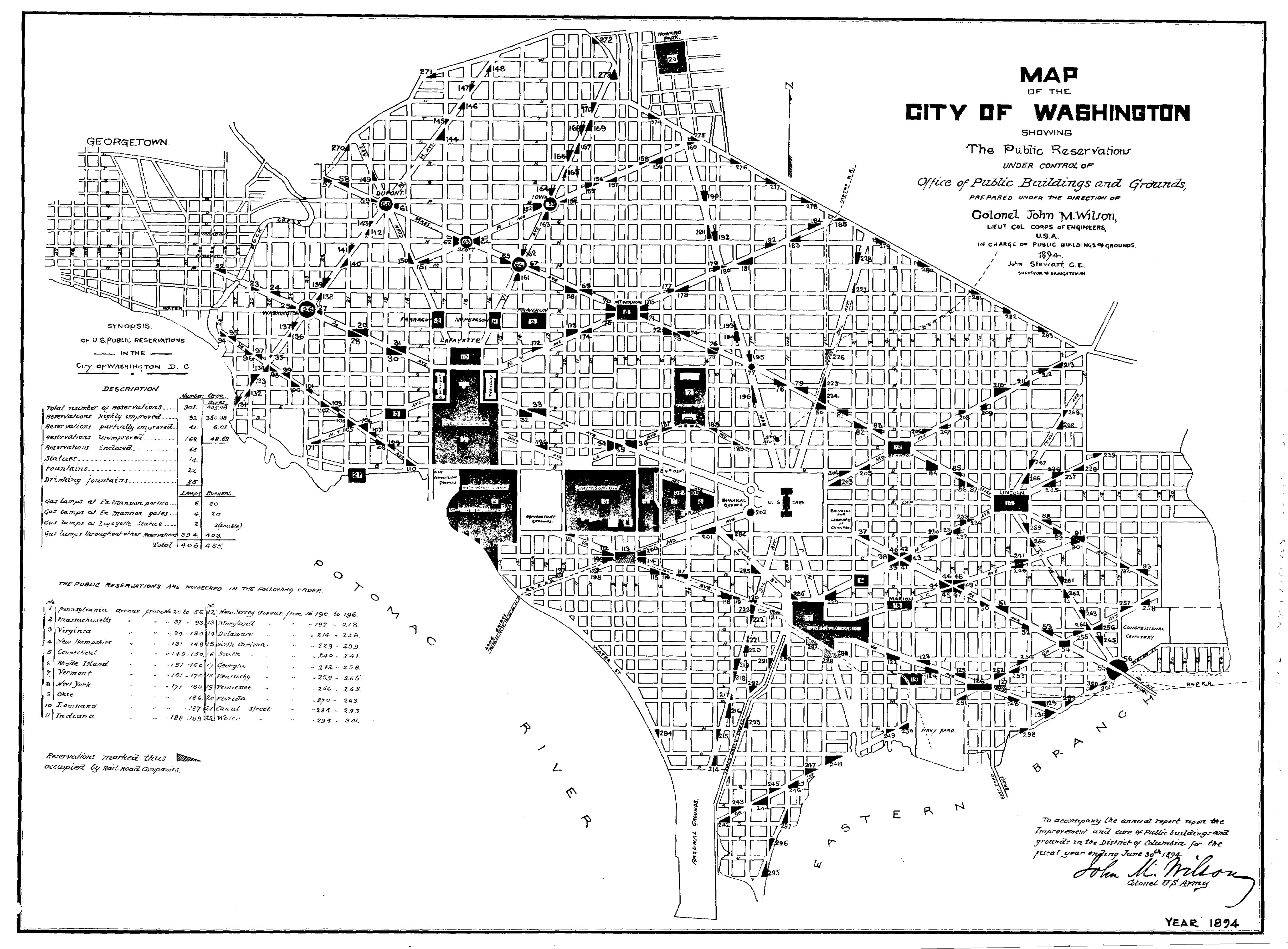
1894 (J. Stewart)
In the 1933, the management of many small reservations (including triangles) were transfered from the Army Corps of Engineers' Office of Public Buildings & Grounds (The War Department) to the National Park Servce (The Department of the Interior). Even later in the 1940s, many of those small reservations would be transferred to the District of Columbia Department of Parks and Recreation. Since then, individual triangular reservations have been transferred to various local agencies.
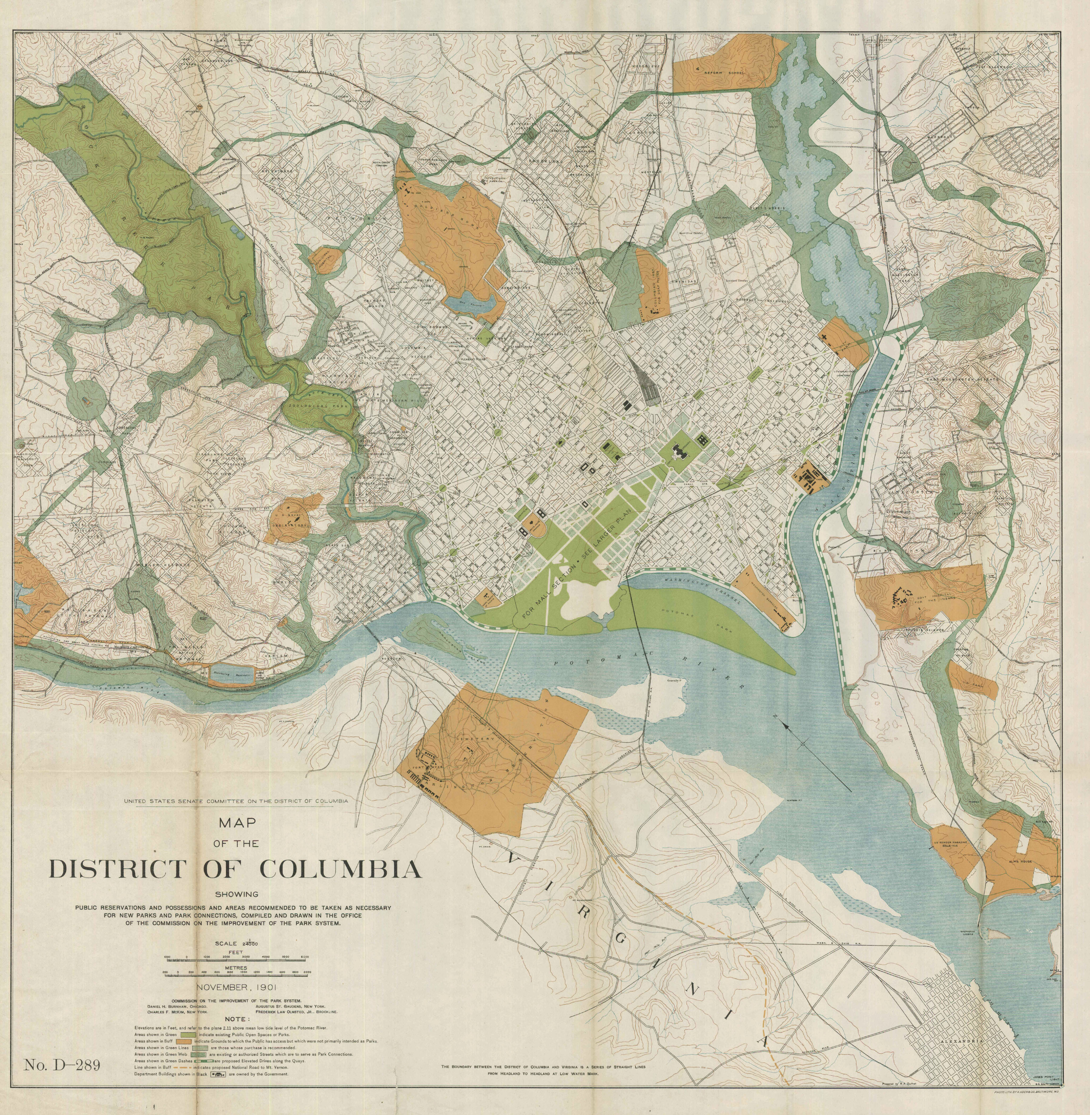
1901 (The McMillan Commission)
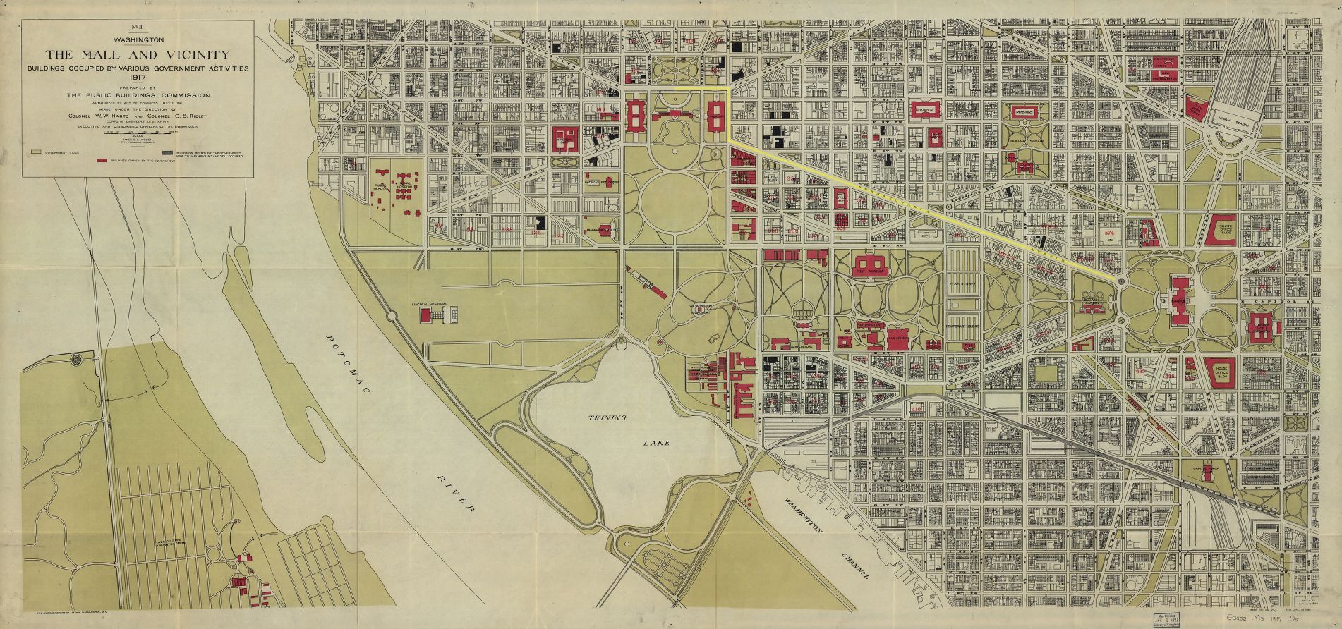
1917 (US Public Buildings Commission )